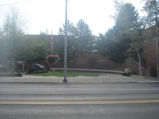
About 17 miles south of Colfax is the college town of Pullman, WA which is the home of Washington State University. Our youngest daughter graduated from WSU. Here's the entry courtyard at the main intersection.

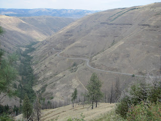
At the top of the hill before Lewiston, ID, there are two ways down: a superslab road and the Spiral Highway (the old road). Which one do I take? Hmmm??? Spiral Highway here I come. Here are a few pictures. Needless to say it's really twisty and is twisty ride number one for the day.


After the delight of riding the Spiral Highway, I headed for Asotin and the start of the Rattlesnake Grade. Of course there was a courthouse in Asotin so I snapped a quick photo. Oops, it's not the 39 county seat ride!

The road out of Asotin heading south is a twisty one in itself but there was no opportunity to take any photos. But here's a map picture from Mapsource.

I went down the Rattlesnake Grade (yes, that's the official name and here's what it looks like on the GPS map. It is a real snake and there's a delightful cafe at the bottom of the grade but I didn't stop there.

Heading up the other side, I snapped this photo of OR3 which shows a little twistiness.

After these sets of twisties, it was a ride down through the farm country of NE Oregon where I tagged yet another cool looking courthouse in Enterprise (Wallowa County)

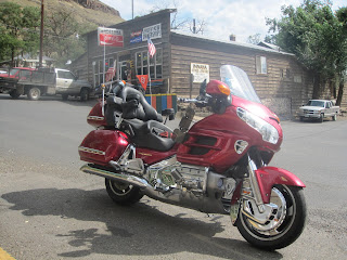
It was just 7 more miles until I reached Joseph where I scored my next cafe tag. I drafted a willing photographer to snag my photo and then enjoyed a "Cup of Ribs" and some broccoli cole slaw and iced tea. The folks here were really cool and excited to see another rider on the Cafe 2 Cafe ride. One fellow was especially interested in the Wing and gave me some advice about the road to Stanley. Hmm, should I follow his tips? What adventure would that lead to?


After refueling at the local Chevron station, I headed for Imnaha which was a little out of the way,

but I had never been there in all of my trips in this area. It was a nice 40 or so mile round trip down there where I snagged the obligatory postoffice and sign shots.


If I were on a dual sport bike I would have followed the sign pointing to Halfway. But I'm not, well at least I don't think so.
Leaving Imnaha, I headed back to the start of FS39 (my favorite motorcycle road in Oregon), it started to sprinkle so I donned a little raingear and rode the 37 miles out to the Hells Canyon overlook (again one of my favorite spots).

Along the way, I found the road that comes from Imnaha via dirt.

While I was there I noticed a BMW F650 and a Kawasaki with WA plates. So I struck up a conversation with them and inquired if they were active on the F650 forum. The fellow was familiar with the site and when I gave him my screen name, he chuckled and said, "You have a pretty farkled up F650", to which I agreed. It's amazing to meet someone on the middle of nowhere who has heard of you. While were chatting, a group of Harley riders walked up to the Wing, looked at the cockpit and said, "He's probably got an internet connection somewhere there!" I didn't have the heart to tell them that I did, but it gave me a good chuckle.
Twisty road leading to the overlook point.


The tree in the above photo has been photographed many times.
Leaving the viewpoint, it was a fun and twisty ride down to the OR86 intersection where I headed east to Oxbow where I missed my turn and ended up in ID and had to come back across the Snake River. Yup, that was a TUT (Tim U Turn). It was one of the few on this trip. There was another I probably should have take the next day, but I would have missed the adventure.

ID71 is a private road (owned by the ID Power Company) which parallels the Snake River heading towards the Brownlee Dam. There were lots of gentle sweepers before crossing the Snake into Idaho where I snapped a few pictures of this large earthen dam. It's noted for good fishing in the area. And the ride up to Cambridge was another twisty one.


Leaving the twisty canyon I crested the hill and came across this display of old farm machinery including quite a few horse drawn combines. Compare these combines to the first picture in this report.


I refueled in Cambridge at the Sinclair service station. Sinclair is one of the few brands in ID that sells gasoline without enthanol. The bike sure runs better on it.
The sun was setting, so I snagged a shadow photo before heading into McCall and the next Cafe.

Arriving at the restaurant after around a 500 mile day, two ladies came out of the restaurant and I enlisted their help in getting a photo.

I phoned Angela and enjoyed a nice steak dinner (a bit pricey) before snagging a motel room next door at the Woodsman Motel.


I hadn't been to McCall for at least 4-5 years, and it was just what I remembered. Here's a picture of the bike at the motel the next morning just before leaving on what would turn out to be the adventure ride of the trip. My room was on the 2nd floor above the Wing.


No comments:
Post a Comment